 The pipeline parallels the road for much of its length, allowing plenty of opportunity to marvel at the amount of effort that went into designing and constructing both the road and the pipeline. Both the road and the pipeline cross the Yukon river on a bridge about 55 miles north of the start of the highway at Livingood (rhymes with jive’n good). The river crossing is the first place you can buy gas on the Dalton. The next gas stop isat Coldfoot, 135 miles north of the river. You need to top-up the tank at every available opportunity. The next gas stop would be at the end of the road at Deadhorse, another 230 miles north, but we didn’t go that far. We spent the night in Wiseman, 10 miles north of Coldfoot, and then turned around and rode back to Fox.
 Why ride only half way up the Dalton, or ride any of it for that matter you might ask...because we wanted to say we had ridden to the Arctic Circle would be the answer. The Dalton crosses the Arctic Circle roughly 60 miles north of the Yukon River. It is the only road you can ride to the Arctic Circle and beyond in the US. A motorcycle tour guide we met in Coldfoot put it well…the Haul road is a notch in your belt ride It's not the prettiest or best road to ride in Alaska, but it is a must-do ride. Somewhat less than half the Dalton is paved…some good, some not so good. The rest is dirt and gravel…some good, some not so good. And when it rained, the dirt sections were pretty slick. On some sections we could run 65 mph, and on some it was more like 35.
The shot below shows the smoke from several forest fires near the start of the road. Smoke was pretty heavy in the air for awhile, until we got beyond the fires. On our return trip, the fires had moved south, much closer to Fox where we were staying…the closest being about 15 miles from the B&B.
 This is the approach to the Yukon River crossing.
This bridge conveys both vehicles and the pipeline across the river.
 We reach our principal goal, the Arctic Circle, about 2 in the afternoon, latitude 66 deg 33’ 44” .
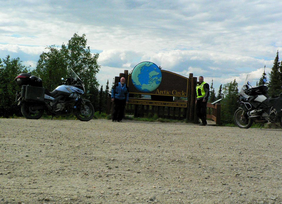


I had to add a shot to my peeing across America series…probably the most significant pee shot yet.
 We spent the night at The Arboreal Lodge in Wiseman, population 15 according to the lodge owner (the 21 population figure I mentioned in the previous post was from the 2000 census).
 Main Street Wiseman.
Wiseman is situated directly on the Koyukuk River, and was founded in 1919 as a gold mining and trading settlement.

The Wiseman Post Office closed in 1956.

 You can’t buy a meal in Wiseman, so we ventured back down the road to Coldfoot for Dinner at Coldfoot Camp. Coldfoot Camp is one of the camps that sprang up during construction of the pipeline to house and feed the workers. They serve an excellent buffet every night with a wide variety of tasty dishes.
 Wednesday morning we rode a few miles further north on the Dalton from Wiseman to the base of the Brooks Range, the northernmost mountain range in the US. As you can see, this 23 mile stretch of the Dalton was recently paved and is as good as any highway we have been on. It is strange how certain seemingly random stretches have been paved with the rest left natural.
 We then turned around and headed back to Coldfoot for gas, and continued on back down to the Yukon River for gas and lunch, and then back to the Fox Creek B&B for the night, passing through some serious fire areas just 15 miles north of Fox.

Truly awesome. Thanks.
ReplyDelete